
Things to Do
Discover the unexpected and exciting activities that Southeast Nebraska has to offer. From historical landmarks and natural wonders to family-friendly attractions and unique local shopping, there's something for everyone. Immerse yourself in the beauty and spirit of the heartland as you explore all that our 14 counties have to showcase!


Highlighting Our Members
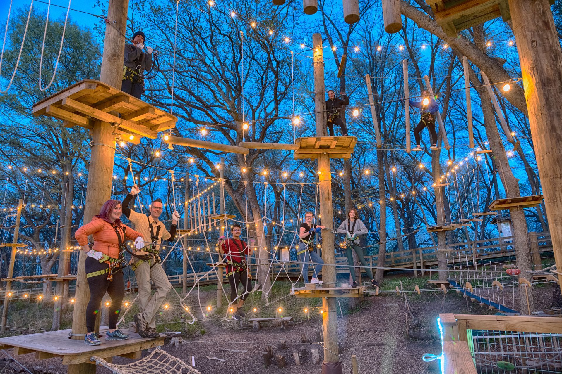
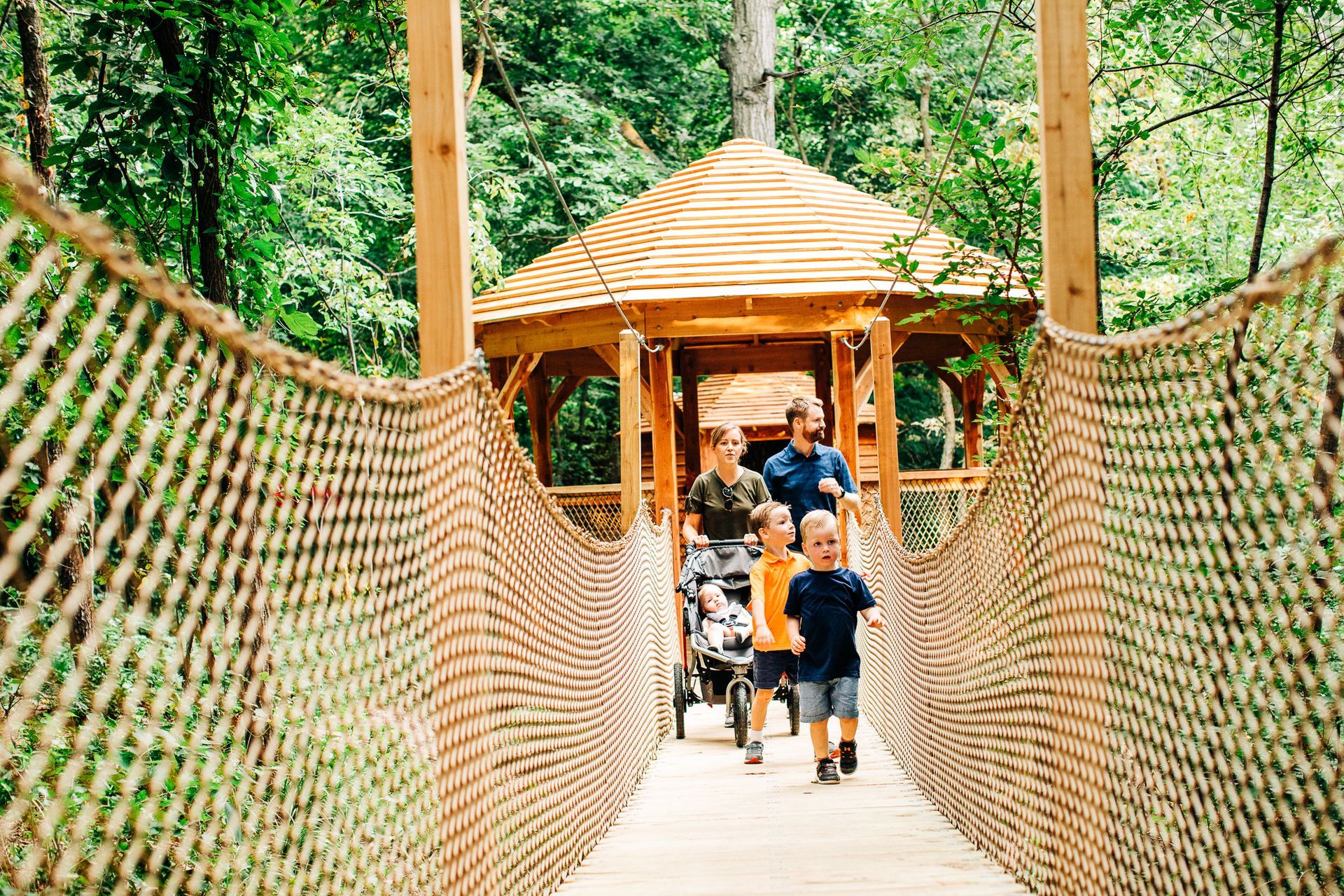
TreeRush Adventures at Fontenelle Forest
Experience the thrill of Tree Rush Adventures in the beautiful Fontenelle Forest of Sarpy County. Navigate exciting high ropes courses that offer fun challenges for all ages and skill levels. Surrounded by nature, this aerial adventure park provides a unique way to explore the forest canopy and enjoy breathtaking views.
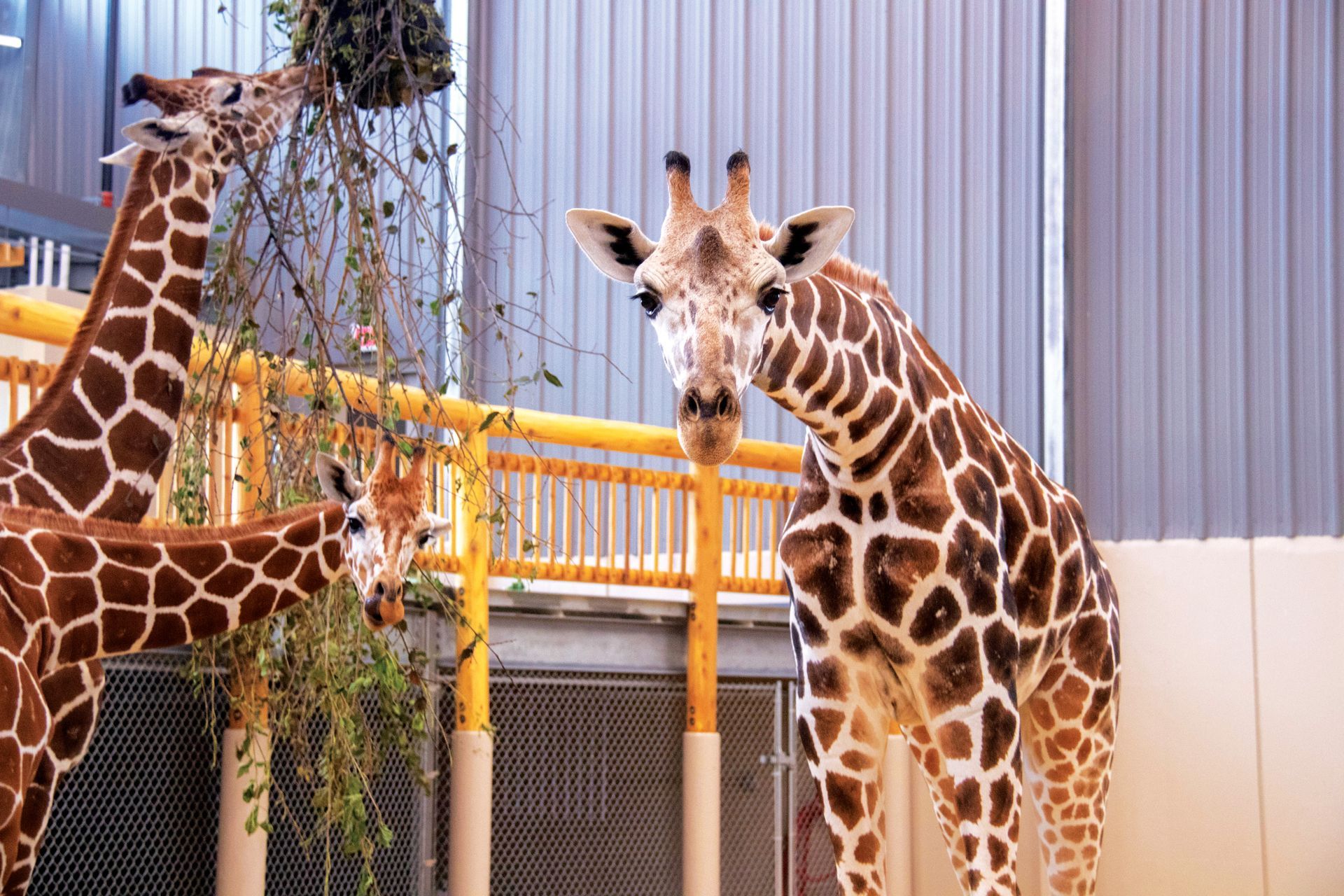
Lincoln Children's Zoo
Discover the joys of Lincoln Children's Zoo in Lancaster County, a place where children and families can get up close with a diverse range of animals. Engage in interactive and educational experiences that foster a love for wildlife and conservation. The zoo offers year-round fun and learning opportunities, making it a cherished destination for all ages.
Robbers Cave
Step into the storied past of Robbers Cave in Lancaster County, a historic hideout that captures the imagination. Explore the underground caverns where legends of outlaws and adventures come alive. This unique geological and historical site offers guided tours that delve deep into its intriguing history.
Homestead National Park
Visit Homestead National Park in Gage County, where you can immerse yourself in the rich history of America's homesteading era. The park features a museum, educational trails, and original homesteads, offering a comprehensive look at the lives of early settlers. It's a perfect spot for history buffs and nature lovers alike.
Great Plains Welsh Heritage Project
Explore the heritage of Welsh immigrants at the Great Plains Welsh Heritage Project in Jefferson County. This cultural center showcases exhibits, artifacts, and stories that celebrate the contributions of Welsh communities to the region. Attend events, view historical displays, and learn about the enduring impact of Welsh culture in the Great Plains.
Whiskey Run Creek Winery & Distillery
Explore the unique charm of Whiskey Run Creek Winery and Distillery in Richardson County. Nestled in a scenic valley, this winery offers tastings of finely crafted wines and spirits in a restored 100-year-old barn. Experience the rich flavors and history of local winemaking in a picturesque setting.
Wunder Roost B&B
Relax at Wonder Roost Bed and Breakfast in Otoe County, where comfort meets rustic elegance. This cozy retreat offers a peaceful getaway with beautifully appointed rooms and warm hospitality. Enjoy a serene environment that makes it easy to unwind and reconnect.
Wildwood Historic Center
Step back in time at the Wildwood Historic Center in Richardson County. This Victorian estate features beautifully preserved architecture and period furnishings, offering a glimpse into the 19th-century lifestyle. Explore the history-laden rooms and lush gardens in guided tours that bring the past to life.
Kimmel Orchard and Vineyard
Visit Kimmel Orchard and Vineyard in Otoe County for a delightful day of fruit picking and wine tasting. This educational orchard provides a fun and informative experience about sustainable agriculture. Savor the taste of fresh, locally grown produce and the estate’s own wines.
Gage County Historical Society
Dive into the local history at the Gage County Historical Society, where the past of Gage County is preserved and celebrated. The museum features a wide array of exhibits and artifacts that tell the story of the area’s development. It's a treasure trove for history enthusiasts looking to explore the heritage and transformations of the region.
TreeRush Adventures at Fontenelle Forest
Experience the thrill of Tree Rush Adventures in the beautiful Fontenelle Forest of Sarpy County. Navigate exciting high ropes courses that offer fun challenges for all ages and skill levels. Surrounded by nature, this aerial adventure park provides a unique way to explore the forest canopy and enjoy breathtaking views.

Planning a Southeast Nebraska Trip? We're Here to Help!
Our 2025 visitors guide shares all things Southeast Nebraska. Download online or request a copy!
Featured Things to Do
Arbor Day Farm
In Otoe County, discover the enduring beauty of nature through interactive trails and educational exhibits. Explore lush orchards and celebrate the rich heritage of Arbor Day in this picturesque setting.
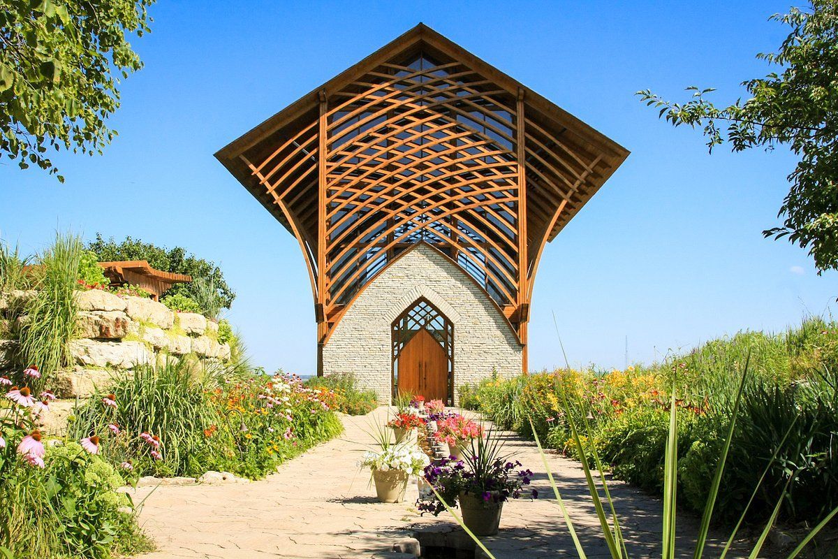
Holy Family Shrine
Experience spiritual peace and stunning architectural beauty at the Holy Family Shrine in Sarpy County. Reflect amidst tranquil surroundings and enjoy the panoramic views that inspire and uplift.
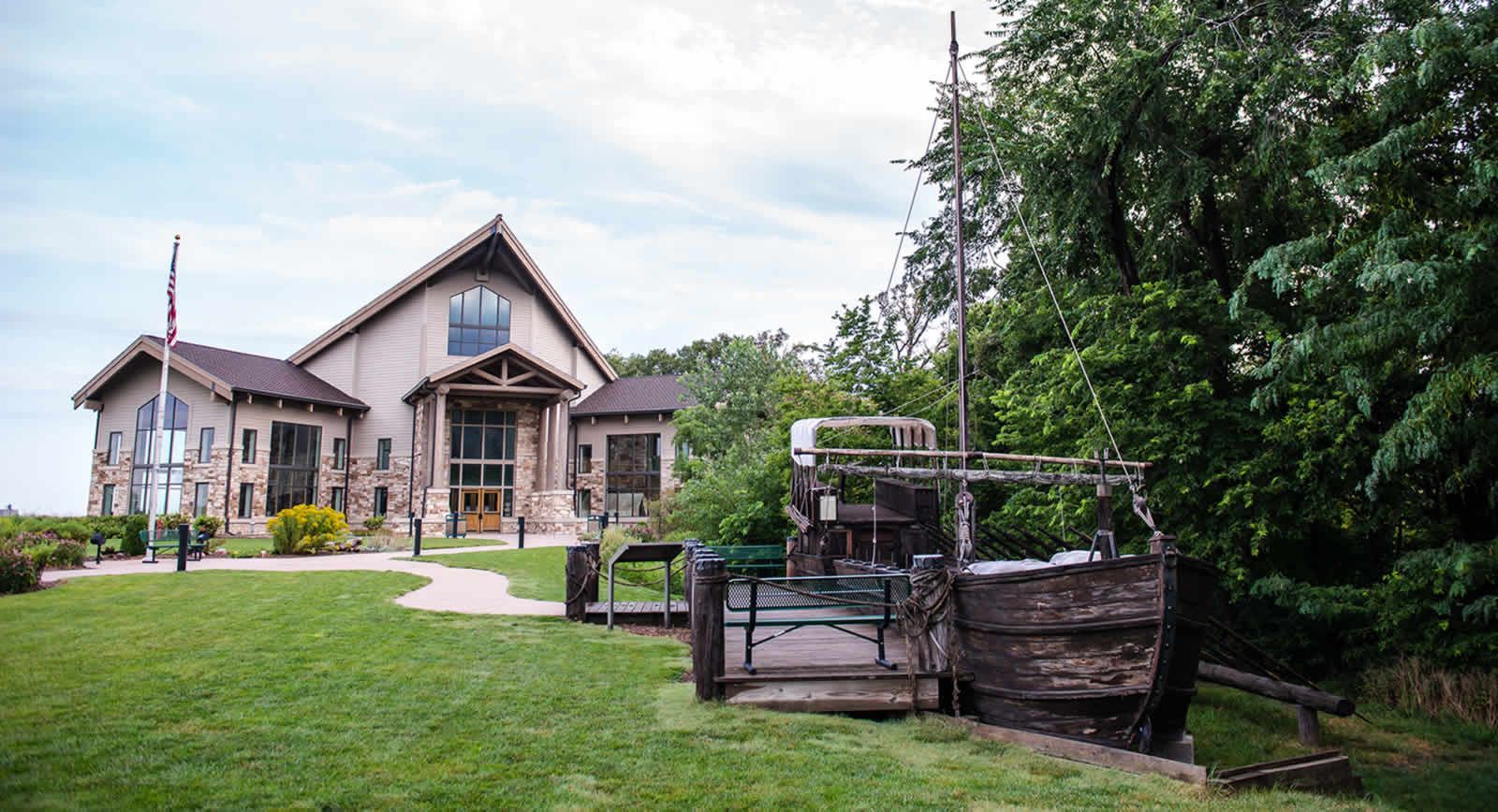
Lewis & Clark Visitors Center
Visit the Lewis and Clark Visitor Center in Otoe County to dive into the rich history of their expedition. Encounter local wildlife and explore interactive exhibits that bring this pivotal American journey to life.

Explore Top Places
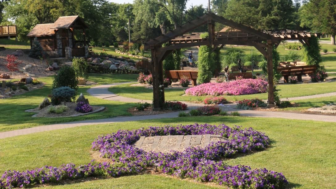
Sunken Gardens
Explore the Sunken Gardens in Lancaster County, an oasis featuring designed landscapes and seasonal floral displays. Wander through themed gardens that offer a peaceful retreat in the heart of the city.
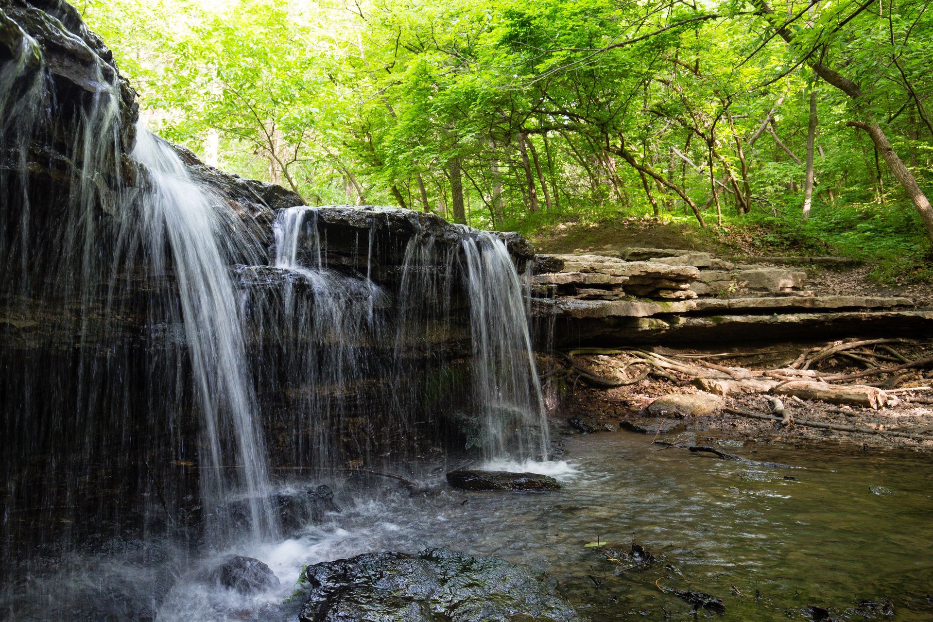
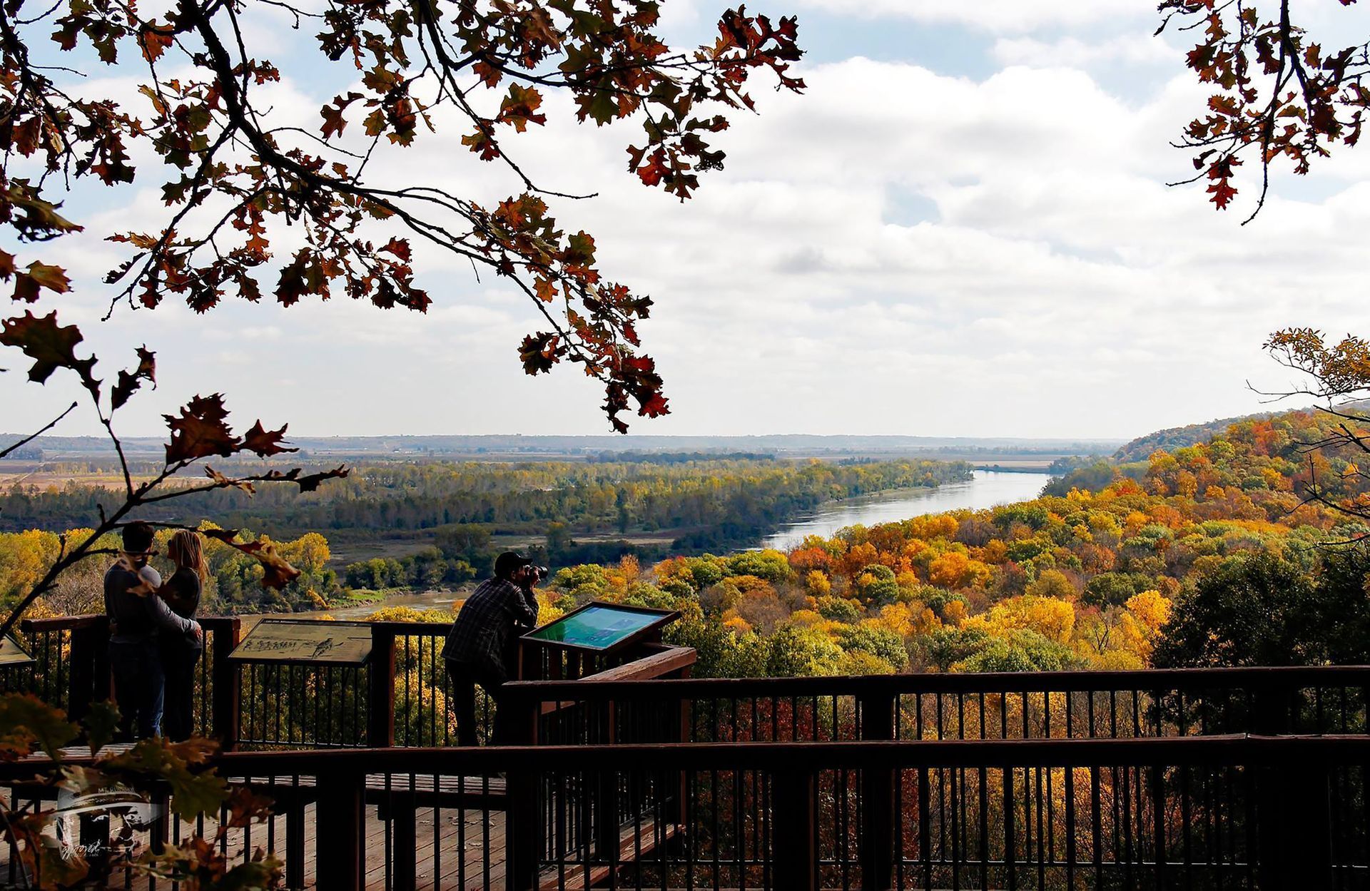
Stone Creek Falls Platte River State Park
Discover the natural beauty of Stone Creek Falls at Platte River State Park in Cass County. Hike to the waterfall, enjoy scenic overlooks, and connect with nature in this vibrant park setting.
The Memorial Cancer Garden
Visit The Memorial Cancer Garden in Douglas County, a serene space dedicated to reflection and remembrance. Stroll through beautifully landscaped paths and find solace in this quiet, contemplative garden.
Sponsored Content
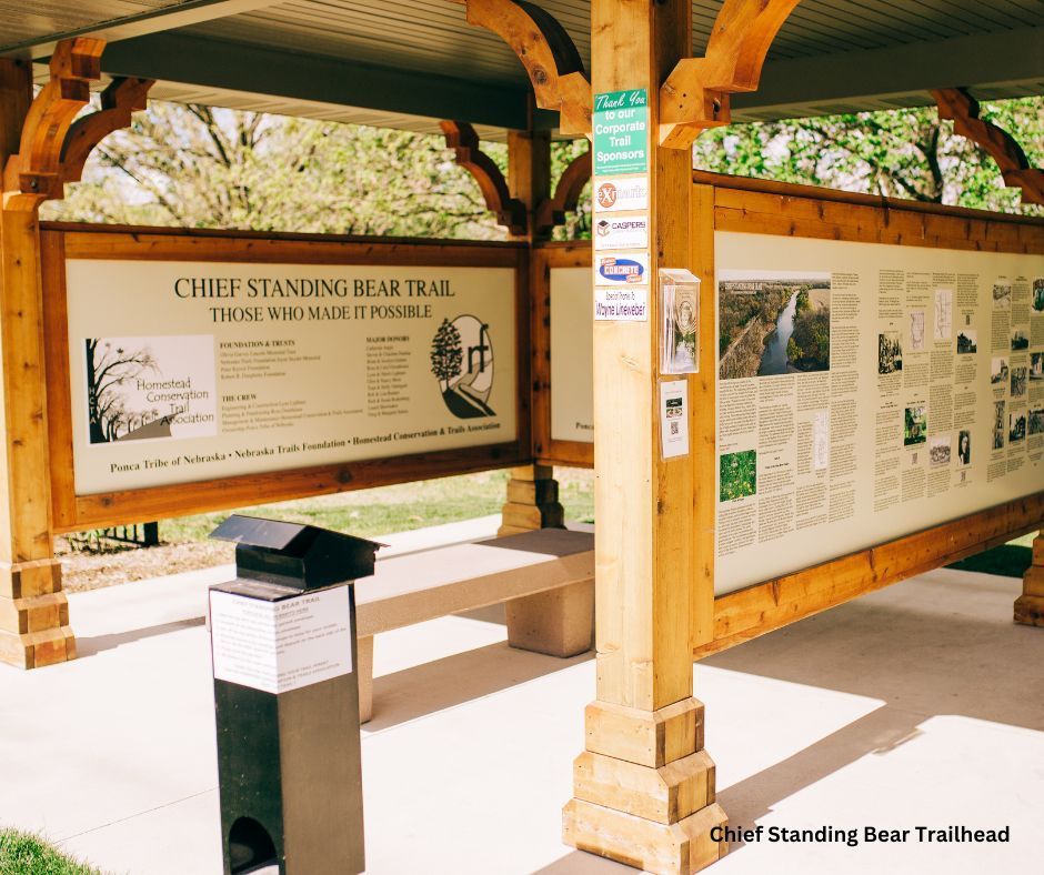
Chief Standing Bear Trail
Explore the historic Chief Standing Bear Trail in Gage County, a path that traces the poignant journey of the Ponca tribe and their chief. This scenic trail offers hikers, bikers, and nature lovers a chance to experience beautiful landscapes while reflecting on a significant piece of Native American history.
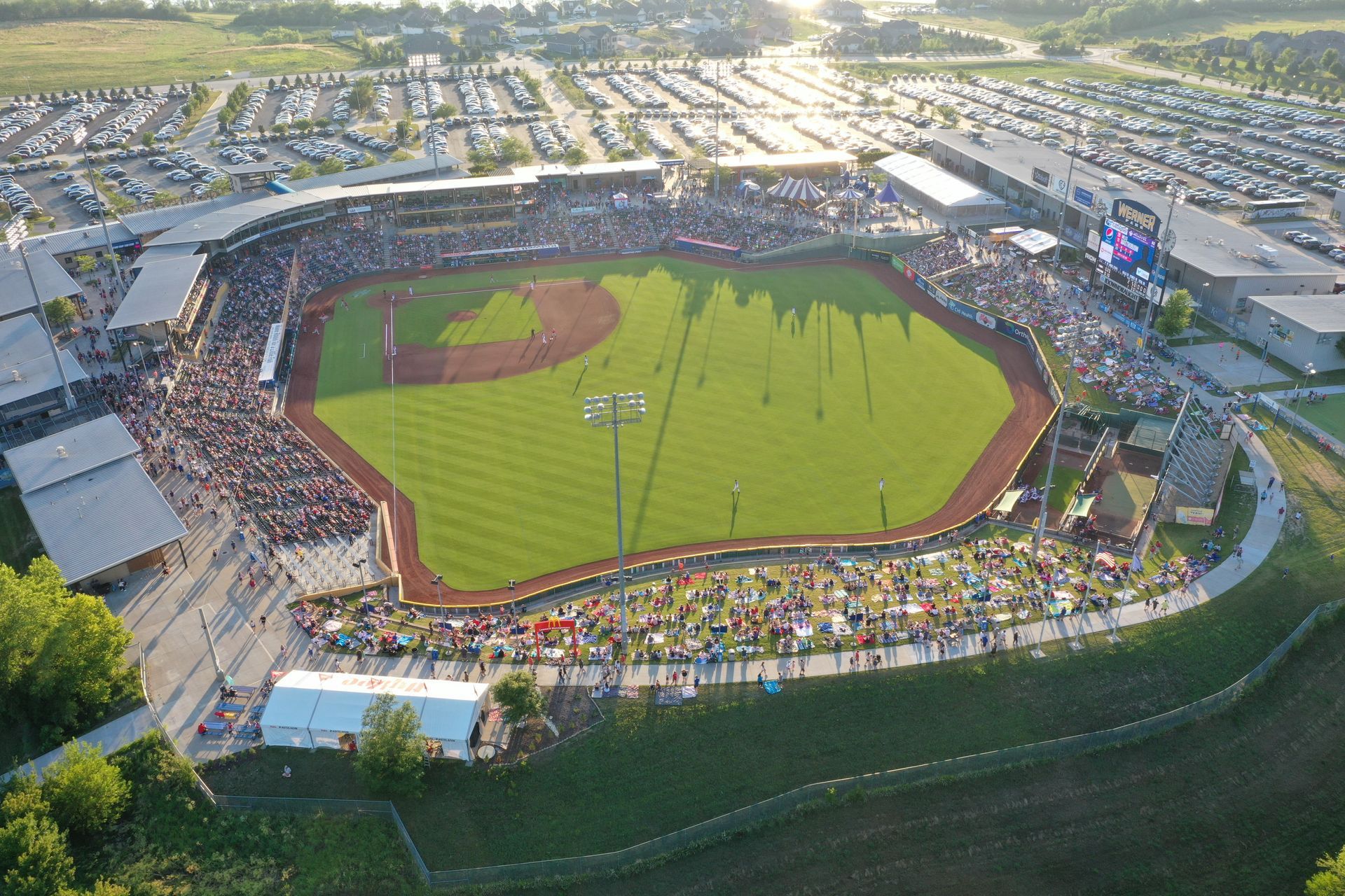
Omaha Storm Chasers Baseball
Catch the excitement of Omaha Storm Chasers Baseball in Sarpy County, where the thrill of the game comes alive. Enjoy America’s favorite pastime in a family-friendly atmosphere that’s perfect for fans of all ages. Experience the action up close and cheer on your local team in a vibrant stadium setting.
Lied Lodge at Arbor Day Farm
Stay at Lied Lodge at Arbor Day Farm in Otoe County for a truly unique retreat experience. This eco-friendly hotel is set amidst the natural beauty of Arbor Day Farm, offering guests luxury accommodations along with activities like tree planting and nature tours. Relax and rejuvenate in an environment that celebrates the legacy of conservation.
Chief Standing Bear Trail
Explore the historic Chief Standing Bear Trail in Gage County, a path that traces the poignant journey of the Ponca tribe and their chief. This scenic trail offers hikers, bikers, and nature lovers a chance to experience beautiful landscapes while reflecting on a significant piece of Native American history.
Things to know before your arrival
Before you set off on your Southeast Nebraska adventure, here are some tips to make your visit as enjoyable as possible.
- Check the weather forecast and dress appropriately to ensure comfort, whether you’re exploring outdoor trails or attending a local festival.
- Make sure to plan your itinerary ahead of time, especially if you’re interested in visiting popular attractions or events. Many sites require advance booking, so it’s a good idea to confirm availability and any potential entry requirements!
- Download the latest visitors guide so you're aware of new and exciting attractions!
1,000,000+
ANNUAL VISITORS
15+
MAJOR ANNUAL EVENTS
200+
HISTORICAL SITES
500+
MILES OF SCENIC TRAILS